
7 Surprising Facts About Czech Tourist Signs

 In brief, we provide nearly all the information you need regarding the signs, including tips on how to navigate without our excellent brands when traveling abroad. For those who enjoy hiking, we also present a comprehensive signpost of the Kudy z nudou portal. The Czech Tourist Club celebrated its 135th anniversary in 2023 and has been dedicated to maintaining thousands of miles of marked trails. Across the Czech Republic, there are 44,000 kilometres of bike paths. Additionally, there are signs throughout the country with a yellow background, resembling directional signs for vehicles — these are intended for cyclists. Approximately 10,000 kilometres consist of long-distance routes, while about 30,000 kilometres are regional and local paths. The lane markings, characterized by vertical stripes, total around 3,900 kilometres of cycling routes. In the winter, cross-country skiers can access around 550 kilometres of trails, and there are 149 kilometres designated specifically for wheelchair users. Furthermore, horse riding enthusiasts can explore 2,800 kilometres of bridleways.
1. Where did the first signs lead?
 The first route established by the Czech Tourist Club was marked in 1889, connecting Štěchovice to the Svatojánské streams. Interestingly, this route did not follow the Vltava River but instead traversed the Kolna saddle. Recently, it has been restored in a vintage style, featuring the original signs along with replicas of historical direction signs. A second route was also created in 1889, identified by number 0001. Its oldest section, named after KČT founder Vojta Náprstek, runs from Beroun through the village of Svatý Jan pod Skalou to Karlštejn. Other original routes included the Krakonoš Trail, built between 1889 and 1894 stretching from Bedřichov to Horní Rokytnice, the Posázava Trail, and the Rieger Trail through the Jizera valley, along with the Palacký trail, and the first long-distance route from Brdy to Šumava, which was completed in 1912.
2. Did the first signs look different?
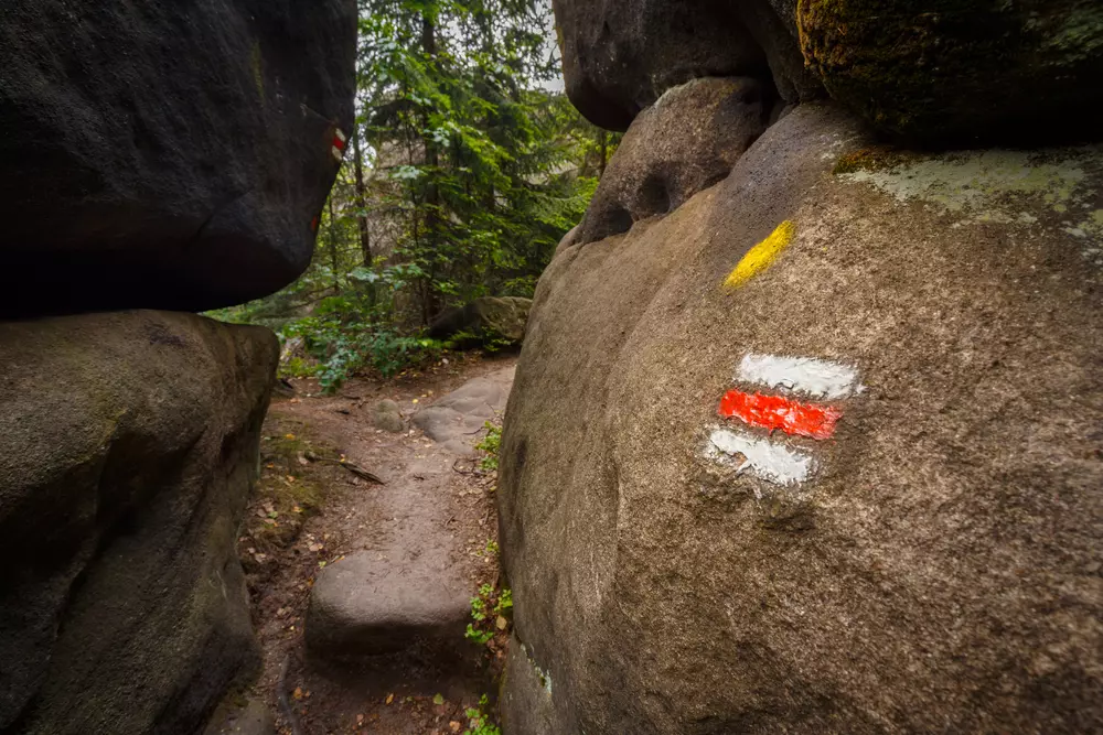
The earliest signs were somewhat larger compared to modern ones: they featured a central stripe that was 10 centimetres wide, bordered by thinner white stripes that were four centimetres wide. Today’s signs measure 10 x 10 centimetres, with all horizontal stripes being of equal width. The middle stripe indicates the route’s color, while the outer white stripes enhance visibility.
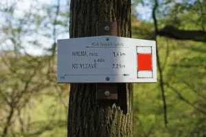
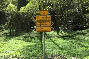
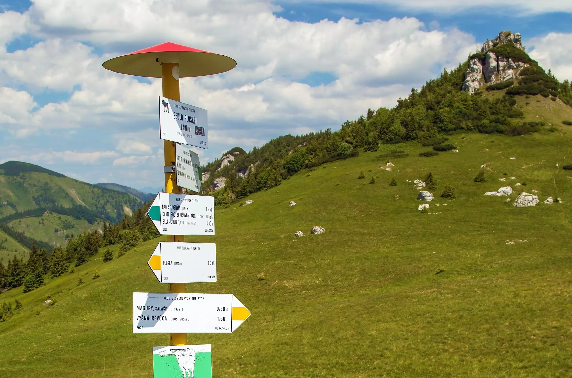
 Before World War I, tourist signs were painted solely in red. Later, blue was added as a marking color, and since 1916, the four colors we recognize today have been in use. The color scheme has specific meanings: red marks long-distance or ridge routes, which are the most challenging. Blue indicates major routes, green points to local routes, while yellow marks shortcuts and connecting paths. At significant junctions, in villages, and near points of interest, additional signposts provide tables displaying location names, altitudes, short texts, and directions to other sites along the routes.
4. What do the individual brands look like and how many will be added per year?
 The Czech Republic boasts over 44 thousand kilometres of hiking and skiing paths, adorned with 67 thousand signposts, as well as more than 40 thousand kilometres of cycling trails. Thanks to the efforts of the Czech Tourist Club, these routes are consistently marked, maintained, and updated. Annually, between 400 and 500 kilometres of new trails are added, while 200 to 300 kilometres are removed.
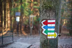
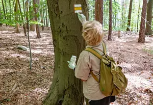
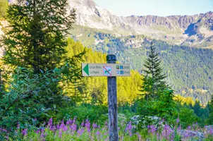
 You likely recognize the pedestrian hiking signs that are marked on the terrain with stripe markers. These consist of three horizontal stripes: two white stripes flanking a middle one that shows the color of the marked route, which can be red, blue, green, or yellow. A square at the end of the marked route replaces the stripe, while a turn towards a castle or another point of interest is represented by an L shape, and a triangle indicates a peak or viewpoint.
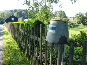
On the Kudy z nudou platform, you’ll also discover how different types of signs are designated for hikers, cyclists, skiers, motorcyclists, horseback riders, or boaters. For cyclists, there are two kinds of road markings: those for road use and off-road. Off-road riders (like those in mountainous areas) are guided by signs similar to hikers, but with colored stripes set in the middle of yellow bands. In contrast with hikers, cyclists utilize white signs instead of yellow ones. For road cyclists, yellow signs featuring a bicycle symbol, akin to those for cars, are employed. Besides indicating the route number, these signs also provide names of destinations and the distance to them. The signs for ski routes generally mimic the markings of hiking trails with the same types, size, and direction signs. The only distinction is in the color of the edge strips, which is orange. The system also incorporates bridleways (hippo trails) for horse riders, marked by a colored circle in a white square. Nature paths, on the other hand, are denoted by a white square containing a slanted green stripe.
5. How are brands painted?
 The Czech Tourist Club receives support from volunteers totaling 1,750 who assist with trail inspections and updating markers. These trails are assessed every three years; missing signs are replaced, the surrounding vegetation is trimmed, and the accessibility of the trails is evaluated. The essential supplies for markers include not just paint and brushes but also stencils for markers, scrapers, gardening shears or saws. Occasionally, it becomes necessary to outline new sections, like those leading to lookout towers, where they may use trees, stones, or stumps. In open areas, special marker pins and self-adhesive markers are often needed to adhere to smooth surfaces.
 If you find this activity intriguing and wish to become a sign-maker, keep in mind that it’s not as simple as it seems. Becoming a marker requires a team; a leader or an experienced instructor from the KČT must supervise the marking (or restoring) of a marked route that is at least 10 km long. This qualifies you as a trained marker but does not grant you the ability to mark independently in the field. If you aspire to lead a team of markers, you may begin training in the following year after becoming a trained marker and, upon successfully passing exams, you can become a senior marker.
6. Who are inspired by Czech brands?
 Similar signage is utilized in Slovakia, Banat, Romania, Croatia on the island of Krk near Baska, and on the island of Zirje. Since 2007, Czech signs have begun appearing in the former territory of Czechoslovakia, specifically in the region of Subcarpathian Ruthenia; there, both Cyrillic and Latin letters are used on the directional signs. The furthest reach of our signs has been to Brazil, around the city of Batayporã, established by Jan Antonín Bata. In 2023, Mongolia joined the countries adopting the Czech tourist marking system.
7. How to walk without our signs?
 Our tourist signs are often admired around the world; however, due to the efficiency of the Czech system, we can sometimes find ourselves lost, confused, or unable to keep pace when abroad. In some countries — including our neighboring regions like Slovakia, Poland, Austria, Germany, as well as France, and Italy, and other places in Europe and beyond — distances are not indicated in kilometres but in terms of time. While this method has its advantages, we are typically accustomed to different systems.
Therefore, we provide a short guide on how to interpret time data: The European standard DIN 33466 is used to calculate time based on coefficients: in one hour, you should be able to ascend 300 vertical meters, walk four flat kilometres, and descend 500 vertical meters. To determine the final time, you need to add extra minutes based on the distance. If the destination is less than 45 minutes away on foot, you add a reserve of five minutes, if it’s an hour or two away, you factor in an additional fifteen minutes, and for distances greater than two hours, a 30-minute reserve is added. Should the route include ferratas, glaciers, or very steep climbs, you need to extend the time further. Additionally, for children’s paths or nature trails, delays must be accounted for concerning the time taken to read information panels along the way, and also for activities enjoyed by little hikers.


